BOOKS - HUMANITIES - Картография Черного и Азовского морей Ретроспектива. Период 1700...

US $8.81

182592

182592
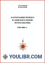
Картография Черного и Азовского морей Ретроспектива. Период 1700-1800 гг
Author: Гордеев А.Ю., Булатов В.Э.
Year: 2007
Format: PDF
File size: 96 MB
Language: ENG
Year: 2007
Format: PDF
File size: 96 MB
Language: ENG
The book was created with the aim of identifying cartographic monuments on which the Black and Azov Seas have been depicted since ancient times. The book contains maps created by world civilization in the period 1700-1800, which display this region. The maps are listed in chronological order, including the image of the map with the main characteristics, bibliography and storage locations, which allows you to use the original directly, or a high-quality copy of this map, for further research. The physical and electronic addresses of libraries, archives, auctions, shops around the world are given, where you can directly, or via the Internet, get acquainted with electronic copies of these maps - the historical heritage of mankind. An annotated list of names with biographical data of cartographers, publishers, engravers, etc. is presented.


